March 2009 Ask the Angry Citizen
![]()
Comments on Burlington Draft Environmental Impact Statement to Adopt a Strategic Program for Comprehensive Flood Hazard Mitigation
[The Draft Environmental Impact Statement itself is hosted here.]
1. Proposed Action – Construct 100-year certified levees in appropriate locations, and provide other flood measures as necessary and appropriate based on FEMA’s final Flood Insurance Study, when this study is adopted following resolution of any appeals. (Page 6)
COMMENT #1: Throughout this draft EIS the term “in appropriate locations” is liberally used. The final EIS should identify where these “appropriate locations” are. Dike 12 levees extend from the terminus of Layfette Road south and west to the Avon Bend area. Contained in that area should be identified where exactly would it not be appropriate to construct a 100-year certified levees.
Also the term “other flood measures as necessary and appropriate” is also liberally used. The final EIS should state with specificity what those measures are and provide a through environmental including but not limited to a complete hydraulic analysis on how those “other flood measures” will impact surrounding communities upstream and downstream of their proposed location.
2. No Action – This is essentially embodied in the current General Investigation study that has been underway for many years by the County and the Corps of Engineers, and because of lack of adequate funding will not be completed until 2018 at the earliest. (Page 6)
Comment #2: The final EIS should provide justification for such a provocative statement. Where did the 2018 date come from? While I am somewhat sympathetic to the cities frustration with the GI process, it is my understanding that the GI process will be completed well before 2018. If the city has information, to the contrary it should provide it in the FEIS.
3. Remove approximately 30 acres of land from the UGA and exchange for land located at the northeast corner of Pulver and Peterson Road for a school site.
The 30 acres currently in the UGA will be returned to agricultural resource zoning and the school site will be redesignated as UGA, from its agricultural zoning classification. Adjacent farmland development rights will be acquired and a permanent urban separator designed along the boundaries of the site, coordinated with the adopted Connected Open Space Plan for Burlington. (Page 6)
Comment #3: Essential Facilities are essential to the health and welfare of the whole population and are especially important following hazard events. The potential consequences of losing them are so great that they should be carefully inventoried. Vulnerability is based on the service they provide rather than just their physical aspects; therefore, not only their structural integrity and content value should be considered, but also the effects of interrupting their functions. Essential facilities include hospitals and other medical facilities, police and fire stations, emergency operations centers and evacuation shelters, and schools.
(Source: http://www.gflrpc.org/Publications/GeneseeAllHazard/CritFacilities&ComAssets.pdf)
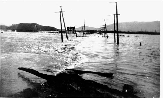
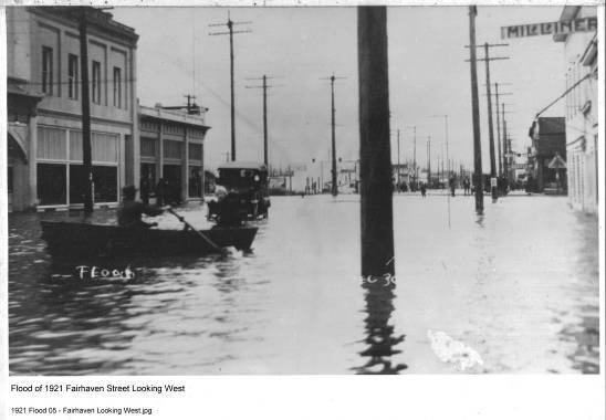
Given the verbiage above why would the City of Burlington recklessly endanger the life and safety of it school children by placing a school, a critical/essential facility in the location that has historically flooded. The photo below is from the 1917 flood event showing waters crossing Peterson Road not far from the location Burlington wants to build its school, in a volcanic floodplain, underlain with volcanic lahar material, adjacent to two active earthquake faults, and located on “prime farmland”. Come on people, this is not a good idea by any stretch of the imagination.
4. Evaluate the concept of adding Raspberry Ridge to the UGA so that sanitary sewer is provided to mitigate potential health hazard in event of a flood.
This area is proposed to be added to the Burlington UGA and zoned as Open Space in order to be able to provide sanitary sewer to the high density farmworker housing that has been constructed on the site that is zoned as Agricultural Natural Resource Land (Ag-NRL). The goal is to protect the citizens of Burlington from contamination by sewage from failed septic systems in the event of a flood. This area was proposed to be included as a sending zone for farmland development rights under the transfer/purchase of development rights provisions adopted in the Burlington Zoning Code in 1994. However, this proposal was rejected by Skagit County at that time. (Page 6)
COMMENT #4: It appears that this proposal is just another excuse to further create intense density within the City. The Final EIS should identify the terminus of the current sewer lines, the route taken to the farm worker housing identifying all properties that would benefit from a sewer line extension, the current zoning of the property and how that could change with city services made available and how the extension is going to be paid for. Given the cities, well-publicized opposition to the farm worker housing project residents must be assured that this is not just another attempt to have them removed from their current location by charging them excessive hookup fees. Given the obvious violation of Executive Order 11988 it is assumed that no federal funds will be used for this project. It is also apparent that the cities presumed worries about “contamination by sewage from failed septic systems” is superficial at best. If the levees fail, and eventually they will as they all do, any possible sewage contamination from the housing project will be the last of Burlington’s worries as every farmer’s manure pit from Burlington to Concrete will also be flowing through Burlington. Not to mention all the chemicals stored within Burlington itself.
The purpose is to stabilize the Base Flood Elevations for the long term future, ensure predictable development standards, protect the public from the 100-year flood (which has a 1% probability of occurring in any year) initially, while planning for and implementing measures to provide incrementally greater protection as time goes by. (Page 9)
COMMENT #5: This statement seems to be adding now another purpose of this proposal. If the City is successful in someday achieving 100-year certified levees what will the cities policy be with respect to requiring development to be built to what elevation? 100 year flood levels or flat on the ground? The Final EIS should also identify by what means the city perceives are available to “provide incrementally greater protection” and what if any environmental impacts those perceptions would entail.
At that time (July 3, 1984), conventional floodways were determined not to be appropriate for the Skagit River delta area for a number of reasons (See Appendix D, Exhibit 6, page 18.) In lieu of a floodway, pursuant to additional study, FEMA accepted a “most probable failure point” analysis, which had the flood overtopping the railroad tracks at Sterling. In Burlington, FEMA helped with a compromise which was to designate Gages Slough a “Special Flood Risk Area.” This area does not have all the qualities of a floodway, but the designation is quite restrictive with flow-through house designs and other elements. Now, a regulatory floodway is being proposed for “later adoption” by FEMA, following changes to the Base Flood Elevations, and it is critical to Burlington that the adopted program of protecting overbank flow paths through farmland preservation be retained as a floodway-like option. (Pages 9 & 10)
COMMENT #6: The comments above are nothing short of incomplete and downright misleading. The FEIS should include a much more thorough analysis based on the documentation below. The base flood elevation analysis consisted of the following: (NOTE: All documents are available for public viewing at www.skagitriverhistory.com under FEMA.)
Source: 4/2/1982 FEMA MFR
Source: 8/22/83 FEMA letter
Source: 12/15/1983 FEMA letter to Burlington
Source: 2/1/1984 FEMA letter to Burlington
Source: 5/22/1984 FEMA letter to Burlington
Source: 11/1/1984 FEMA letter to Skagit County
Thus we can tell from a review of the above documents that FEMA performed their analysis as if the levees did not exist (thus giving the residents of Burlington a terrible false sense of security on how deep the water will be in case of a levee failure) and that the informal floodway in the lower valley was from the landward toe of the levees to the landward toe of the levee on the opposite side of the river. Also since a regulatory floodway was not established that Burlington was to conduct themselves under 44 CFR 60.3.(c)(10) meaning that “no new construction, substantial improvements, or other development (including fill) shall be permitted within Zones A1-30 on the community’s FIRM, unless it is demonstrated that the cumulative effect of the proposed development, when combined with all other existing and anticipated development will not increase the water surface elevation of the base flood more than one foot at any point within the community.” The FEIS should extensively discuss and show with hydraulic analysis that the massive development east of Interstate 5 has not already raised the flood waters more than one foot at any point in the community, especially concentrating on the area east of the interstate. The FEIS should also speak with specificity to the issue of where it has or as the case may be why it has not ever enforced the verbiage of 44 CFR 60.3.(c)(10).
The relicensing of the Baker Dams for an additional 50 years includes agreements for funding mitigation actions of many kinds, and expenditure of funds to accomplish those goals; however, flood hazard mitigation is not currently being addressed, and no funding has been set aside to upgrade the spillways on Lower Baker Dam. Without the ability to more quickly evacuate water in advance of a flood, any future benefits of additional flood storage in this river system cannot be counted on to assist in taking the peaks off flood events. Puget Sound Energy has stated that they intend to work with local jurisdictions on an informal basis. The November 2008 flood threat was handled extremely efficiently with the Corps of Engineers taking over operation of the dams and the peak flood elevation was reduced by about four feet. (Page 10)
COMMENT #7: Instead of touting the dam owners with their failures to provide Burlington with not promoting further growth in the bottom of a volcanic floodplain by forcing them to provide something that Burlington has not yet stated that they are willing to pay for, the public would be better served if the FEIS shows how while the smaller flood events in recent years have in fact been better managed by the Corps and the dam owners that this style of management has a downside as well as it lulls the lower valley into another false sense of security that makes people believe that they are totally protected by the storage already provided by the dams. The FEIS should verbalize that neither the Seattle City Light dams nor the Puget Sound Energy Baker dams have the capacity to contain large flood events and that once their capacity has been reached it will be like the dams did not exist at all and major damage will be the end result within the lower valley floodplain.
For the mainstem Skagit system, Ross Dam and reservoir provide valuable flood storage during the winter flood season; however, the availability of this flood storage must be moved to mid- October, instead of 1 December as the license currently allows. (Page 10)
COMMENT #8: While this is an admirable purpose/goal the FEIS should extensively address how the City of Burlington will finance the loss of generating capacity to Seattle City Light.
It is the City’s position that these Base Flood Elevations, if adopted, will have a severe, long term negative impact the economy of the region. Immediate effects will be on the redevelopment of old downtown, where the lots are 30 feet wide. Elevating the first occupied floor up one story will be a difficult and costly challenge for property owners and the community. The market conditions for redevelopment of old downtown are slow to emerge and there is no predicting the timeline for revitalization at this point. (Page 11)
COMMENT #9: While there is no dispute that elevating buildings is a “negative impact” on the pocketbooks of developers, said negative impact is far outweighed by the safety provided by such elevation to the residents/businesses that move into said structures. The FEIS should in detail discuss the cost involved of raising a building either on fill or post and pier construction versus the damage to the contents of a business when the levees break and a catastrophic flood event occurs.
4. A viable regional strategy is not in place.
An array of flood hazard mitigation strategies exist and have been studied for many years in Skagit County, but there is no regional strategy for approving or implementing them. Skagit County is working toward development of an update of the Skagit County Comprehensive Flood Hazard Management Plan. The City of Burlington is not represented on the Advisory Committee and the scope of work appears limited to the Corps of Engineers General Investigation without consideration of independent studies by Burlington and Skagit County. There does not appear to be an emerging consensus on the best course of action, for a number of reasons, including the fact that few of the proposed measures will work with the hydrology set forth by the Corps.
Some of the relevant components include flood storage at Lower Baker Dam, better utilization of the Nookachamps area for flood storage when combined with better protection of the Sedro-Woolley sewer plant, extending levee protection along the railroad east of Burlington to a point so the site does not require flood fighting, setting back the levees in the multiple bridge corridor through Burlington and Mount Vernon, and protecting overbank flow paths in lieu of a regulatory floodway. (Page 11)
COMMENT #10: I would first like to address the text highlighted in yellow above. While it is true that the City of Burlington is not a sitting voting member on the Advisory Committee, the City has its City Planner as the chairperson of the Land Use Sub-Committee and Dike District 12 (Burlington’s admitted partner in this DEIS, sits on the Dike and Drainage Sub-Committee both committees of which report to the Advisory Committee. If the City of Burlington really feels that it needs three bites at the apple then maybe they should contact the Mayor of Mount Vernon who has boycotted the last 6 months worth of meetings and who refuses to give his voting proxy to his City Engineer or other City employee and see if he would be willing to give up his seat at the Advisory Committee table to the City of Burlington. While I have no authority to speak for the rest of the members of the Advisory Committee I for one would welcome the City of Burlington taking Mt. Vernon’s place.
With respect to the second paragraph while I must admit that the process is painstakingly slow progress is being made. At the last Advisory Committee meeting the committee endorsed the GI study evaluating Lower Baker Dam storage, threw out the “better utilization of Nookachamp Storage project” as a project that will not work for many reasons including impacts on salmon, ownership of the levees proposed, cost, and as Burlington has often admitted a project that will not work unless their consultants hydrology is used. Not to mention the fact that this project had been looked at in 1966 and again in 2001 and rejected both times.
If the City of Burlington strongly feels that extending levee protection to Sedro Woolley is a viable option then the FEIS should include a complete hydraulic analysis to show the impacts on upstream and downstream property owners. In 1979 the Corps GDM stated that such action would increase BFE’s by about 4 feet which clearly would be unacceptable to those impacted.
b. Burlington strongly supports participating in the National Flood Insurance Program. The only viable option for the City at this time appears to be taking expeditious action to get the levees certified for 100-year flood protection, including any related actions such as training levees, control mechanisms to move water north to overbank flow paths through farmland areas, ensuring Gages Slough is protected as a flood drainage mechanism and facility, and other measures. This will ensure that the levees are given credit in setting the Base Flood Elevations and that the elevations are reasonably close to the existing condition. (Page 12)
COMMENT #11: The FEIS should state with specificity when Burlington states “get the levees certified for 100 year flood protection” if it means the entire levee system or as it stated in paragraph #1 page 6 “in appropriate locations”. The FEIS should state where the “appropriate locations” are if it is the latter. It should also state how high the levees will be for them to be certified as compared to how high they are now. Also the FEIS should indicate the width of Gages Slough (high ground to high ground) and the amount of water the City feels will flow through this area.
c. With certified levees, flood insurance may become optional in some locations. The City of Burlington will continue to strongly support the flood insurance program. (Page 12)
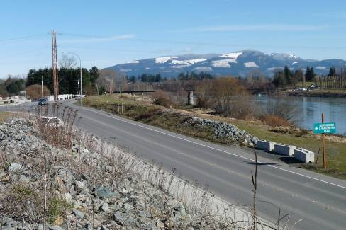
COMMENT #12: Really? Just in some locations? The FEIS should state with specificity which areas if feels will not need flood insurance.
How about this area? Will it be out of the 100 year floodplain and if so does that mean that all property south to the Skagit River behind the levees will also be out of the 100-year floodplain?
3. FEMA has also proposed creation of a Regulatory Floodway at some point in time after the Base Flood Elevations are put in place. It is the City’s position that the Regulatory Floodway issue must be considered together with the Base Flood Elevations and the correct hydrology and hydraulic modeling, so that cumulative effects can be evaluated and a responsible course of action can be selected. (Page 12)
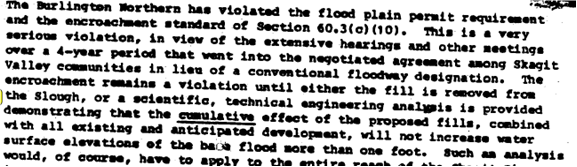
COMMENT #13: Any regulatory floodway must be based on reality, meaning where the waters will be flowing. The deeper the water and the faster the current the more the area should be considered as a floodway. Under existing conditions, no waters will cross Interstate 5 from the Skagit River north until they reach the Gages Slough area next to and including the Cascade Mall. WSDOT purposely designed the freeway to overtop in that location. From there the waters traverse overland to Padilla Bay. The path of the floodwater current has long been known to Burlington and Skagit County residents. See below:
Source: 5/1/1928 Corps of Engineers Skagit River Report to the Board of Engineers for Rivers and Harbors

![]()
Source: 9/26/1922 GNRR letter and Robert Herzog Report
Unless the City of Burlington widens the 3 bridge corridor more then its current plan of only 400 feet, gets the water past the City and gets rid of it before it gets to Mt. Vernon as it has been described in the two documents above, there is no other alternative to keep the floodway designation from going through Burlington.
Given the uncertainties with points 1-3 above, it is therefore the City’s position that the best option for Burlington is to devise a plan to obtain 100-year levee certification for the Burlington Urban Area, and update the existing Special Flood Risk Zones as a comparable alternative to a classic regulatory floodway that is specifically designed to work in the Skagit River delta area. (Page 13)
COMMENT #14: This is a terrible option for our second largest urban area to undertake. Levees are the worst form of flood control available to mankind. All they do is promote a terrible sense of false security. Giving the floodwater a place to go instead of trying to keep it out is a far better option. The FEIS should include an analysis of widening the three bridge corridor and providing an emergency outlet for floodwaters in any greater amount then the 1990 flood event. All other options harm individual property owners more then they currently are being harmed. The emergency outlet option does not provide any more harm then will currently be experienced under current conditions. This option also has the impact of lowering the BFE figures for Burlington and Mt. Vernon, and perhaps most importantly does away with the floodway designation for both urban areas.
1. Impact of 100-year flood protection on Burlington and surrounding areas, including analysis of levee height, levee configuration and other flood control measures, and design options for those measures, based on a comparison of Corps of Engineers versus Pacific International Engineering hydrology alternatives and assumptions about Baker Dam storage, Nookachamps storage with Sedro-Woolley protection, control structures in the Sterling area, overbank flow paths to the north and west, and levee setbacks through the bridge corridor. (Page 13)
COMMENT #15: See discussions in comments #10 and #14 above. Almost everything mentioned in the paragraph above is a complete waste of time and money. Especially putting control structures in the Sterling area and establishing a flow path to the north into the Samish Valley. The last thing the Samish farming community needs right now is more induced flooding.
There are two major alternatives presented: one is to modify existing levees, including certification of some levee segments, and take other appropriate flood control measures based on the hydrology developed for Skagit County, Burlington and Mount Vernon by Pacific International Engineering that is not currently accepted by the Army Corps of Engineers. At present it is not known if FEMA will accredit levees certified using this hydrology. (Page 14)
COMMENT #16: The PIE hydrology has been rejected by every federal and state agency involved for several years now. The chance of FEMA or the Corps accepting the PIE hydrology is on its best day slim and next to none.
The other major alternative is to modify existing levees, including certification of some levee segments, and take other appropriate flood control measures based on the Army Corps of Engineers hydrology, if that becomes the basis for the new FIRM maps, and to evaluate options within that framework. (Page 14)
COMMENT #17: If this is in fact the chosen major alternative then the FEIS must include the location of said levee segments, how they will be modified during the certification process and what the impacts of said modifications will be to upstream and downstream property owners. Also the FEIS should state with specificity on what the other flood control measures will be and what the cumulative impacts (in accordance with 44 CFR 60.3.(c)(10)) of those measures as well as what will be the impacts to upstream and downstream property owners, their impacts on the environment and what will be the economic cost and how will the measures be funded.
2. Levee upgrades require coordinating with Dike District #12 and Skagit County on the location of levees and control structures. In order to protect the urban area, some of these will of necessity be constructed in Skagit County’s rural jurisdiction in. (Page 14)
COMMENT #18: The FEIS should elaborate on exactly what “levee and control structures” will be constructed in Skagit County’s rural jurisdiction and what are the hydraulic and environmental impacts of said structures.
► Land added to the UGA at the northwest corner of Burlington is proposed for a future school site. In order to comply with the Skagit County policy of “no net loss” of land that is zoned Agricultural Resource Land, a comparable amount of farmland is proposed to be removed from the northeast corner of the Burlington UGA just east of Burlington Hill. (Page 14)
COMMENT #18: See comment #3 above. Really people, this is a terrible idea. I don’t care how many $100,000’s of dollars the school district paid for the land. They made a bad investment of district dollars.
OBJECTIVES OF THE PROPOSAL
¨ Revise the existing FEMA approved alternate to the regulatory floodway to clarify the role of Gages Slough, to add overbank flow paths that include the Nookachamps drainage basin and farmland located to the north and west of Burlington Hill. (Page 16)
COMMENT #18: See comments 13 and 14 above. This is a terrible objective which will ultimately alienate your neighbors and receive no public support amongst the voters of Skagit County and you will end up with exactly what you got in 1979…….nothing. No public support equals no funding.
¨ Develop and implement reasonable and prudent alternatives such as those presented in the NPDES Phase II Municipal Stormwater permit, Burlington Connected Open Space Plan, the Gages Slough Management Plan and related alternative future concepts, to comply with all local, state and federal environmental requirements, including the Endangered Species Act. (Page 16)
COMMENT #19: Admirable statement however given Burlington’s, Skagit County’s and FEMA’s lackadaisical approach to code enforcement I don’t hold out much hope that all local, state and federal environmental requirements will be enforced. Look at the following to see what I mean:
4 feet of fill material placed on the riverward side of the levee in 1990, in the floodway just 6 years after the adoption of the local flood ordinance.
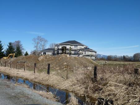
Massive fill being placed in a flow path just upstream and adjacent to Gages Slough in an area where the levees broke in January 1935. See 1/31/35 C.H.
Source: 2/20/1987 FEMA letter to BNSF.
While to my knowledge this is the only time CFR 44 60.3(c)(10) has been enforced, the fill material BNSF railroad placed in Gages Slough is still there today.
¨ Address the unresolved national and state environmental policy issues, including the requirement for NEPA review of the change in the FEMA Levee Failure Policy., FEMA has taken the position that the agreement reached in 1985 when the Flood Insurance Rate Maps were first set up in the Skagit River Delta Area is no longer valid. At that time, there was no regulatory floodway established because it is not practical in this situation and the levees were assumed to fail at a single point. Today, FEMA is stating that if the levees are not certified to 100-year flood protection, they are assumed not to exist at all for the purpose of setting base flood elevations. Rather than consider the issues together, FEMA is also proposing to establish a classic regulatory floodway through the Skagit River delta area at an unknown future date. (Page 16)
COMMENT #20: The levees have never been considered in establishing BFE’s in the past. See documents contained in comment #6, specifically the 5/22/1984 FEMA letter to Burlington. The FEIS should change the above paragraph appropriately to reflect what actually happened. The only difference today is that the BFE’s are determined as if only one side of the rivers levees fail unlike 1984 when no levees were considered and “sheetflow flooding” was the method used.
There is little debate about the need to protect existing developed urban areas from flooding. However, there is a great debate about what constitutes 100-year flood protection and how much water arrives in the Skagit River delta in that flood event. It is expected that this debate will escalate once FEMA makes a decision on flood hydrology, and produces new Flood Insurance Rate Maps. The City of Burlington and Dike District #12 are prepared to file technical appeals if necessary. Extensive levee enlargement work has been in process since 1990 by Dike District #12. With correct flood hydrology in place, the feasibility of obtaining 100-year levee certification would be improved. The process involves certification by a private consultant with review and accreditation by FEMA. This is a recent change from past practice, with substantially less direct federal involvement in the process. (Page 16)
COMMENT #21: Nice to see that Burlington is prepared to make consultants’ rich because I really feel that is all that would be accomplished. Appealing and ultimately taking the issue to court will result in a resounding defeat for the City, its taxpayers, and make only the consultant assisting the City happy as he laughs all the way to the bank. The City Council needs to seek outside legal advice before this course of action is taken.
Land Use – There is a clear need for permanent acquisition of farmland development rights to provide paths for floodwaters to move during a major flood event. This option is critical to protect Burlington from becoming a regulatory floodway. (Page 16)
COMMENT #22: The FEIS should identify with specificity where these “farmland” areas are and exactly how Burlington plans on moving the water onto these “paths”.
Floodway or “Floodway-like Tool” – Gages Slough is currently identified as a Special Flood Risk Area with some, but not all, of the restrictions that would be in place if it were designated as a floodway; however, Gages Slough cannot carry enough water to be considered a floodway conveyance area. The Skagit River, from a point three hundred feet behind the landward toe of the levees across the river, is considered a Special Flood Risk Area and the typical floodway rules apply in this area. The proposed addition to the program is to protect farmland that will provide overbank flow paths, the actual course of floodwaters in a flood event. FEMA is proposing to establish a floodway or floodway-like tool, but there is no information or schedule for this action and it needs to be considered together with the Base Flood Elevations, and the proposals outlined in this document. (Page 17)
COMMENT #23: The FEIS needs to state clearly what documentation Burlington is relying on to make the Gages Slough statement. Gages Slough is the old channel of the Skagit River before it moved to its current location approximately 1,500 years ago. If the slough is recognized that it is not just where the water is sitting but the high ground area to the high ground area it is several hundred yards wide and will contrary to popular opinion carry a significant amount of water and in most cases at a high rate of velocity. Before the FEIS can be published, a complete topo map and hydraulic analysis should be conducted. It has carried the water before and it will carry the water again. It is only a matter of time.
Further Study - If the flood hazard mitigation issues for the City of Burlington cannot be solved, further study will be necessary, and there will be significant adverse effects that cannot be mitigated. These include gradual deterioration of the city and loss of economic vitality, loss of protection of major regional transportation infrastructure, inability to continue with ecosystem restoration efforts and continued poor storm water quality entering the Skagit River, as examples. (Page 17)
COMMENT #24: This paragraph is nothing but a scare tactic to generate commercial interest in the proposal. Our neighbors to the south in Lewis County have experienced 500 year back to back flood events. Despite the hardship imposed on the poor and the homeowners, commercial development apparently is still continuing, no matter how foolish it might be. The FEIS would be a lot more creditable if this paragraph was modified to explain the terrible inconvenience of flooding events instead of trying to scare residents into this holistic approach of public policy.
SIGNIFICANT IMPACTS, MITIGATION MEASURES, AND SIGNIFICANT
UNAVOIDABLE ADVERSE IMPACTS
This is a programmatic environmental impact statement intended to address planning issues related to flood hazard mitigation including levee certification. The typical environmental impacts of site preparation and construction are addressed by the existing land use and construction codes and are not considered significant adverse effects and they will be adequately mitigated. Supplemental environmental assessments ranging from biological assessments and evaluations to discipline reports pursuant to NEPA will be incorporated into the program as they become available or required. (Page 18)
COMMENT #24: With respect to the highlighted text above I view this as a public admission that this DEIS document is nothing more then a total BS exercise that contains no specifics, no environmental analysis with the final conclusion of “trust us the check is in the mail”. I’m sorry if that seems kind of harsh but this document accomplishes nothing other then a feeble attempt to say that you recognize that you have a problem but whatever you need to do is covered by existing codes so you can do anything you want to. What a waste of taxpayer’s time and money. If I was on the Burlington City Council, I would be outraged that staff spent any money on this document at all.
There will be an unavoidable adverse impact on frequently flooded farmland and rural residential areas that are located in overbank flow areas when flooding occurs. This is an existing condition. (Page 18)
COMMENT #25: If this was indeed a true EIS it would address what those adverse impacts would be and to what degree Burlington’s plans will make them worse. One is now left with the impression of what is it exactly that Burlington is trying to hide.
Levee certification may result in more water moving down the river past Burlington, with potential impacts to rural and agricultural lands if there is levee overtopping or failure downstream. (Page 18)
COMMENT #25: It “may result in more water”? The FEIS should have a complete analysis of the quantity of water moving downstream and what plans does Burlington have to mitigate that impact?
Levee setbacks are planned through the three-bridge corridor on the south side of Burlington. The setback area will be maintained as part of the Burlington Connected Open Space, affording new potential opportunities for public access, buffer enhancement, and flood hazard mitigation, all of which will benefit fish and wildlife and their habitats. Preliminary study with regard to the three-bridge corridor has identified the 100-year old BNSF railroad bridge, at the upstream end of the corridor, as a restriction to flood conveyance. (Page 18)
COMMENT #26: As the below diagram shows it is not the BNSF railroad bridge that is the restriction to flood conveyance as much as it is the configuration of Dike 12 and Dike 17 levees. The below diagram was provided by a hydraulic analysis performed by nhc of the impacts of induced flooding due to the current levee system. Even if you accept the argument that the bridge acts as an impediment to flood flows the impacts of said impediment are minuscule as compared to the levee system itself as the flood waters simply scour out the area under the bridge. The FEIS needs to identify the amount of levee setbacks planned by the City of Burlington, Mt. Vernon, Dike Districts 12 & 17 and the WSDOT.
Additional studies will be prepared as part of the request for levee certification, addressing issues of environmental justice and archeology and historic preservation and completing the Endangered Species Act consultation process. (Page 18)
COMMENT #27: Interesting choice of words but the FEIS should explain in detail what is meant by “environmental justice”.
There really isn’t very much contained in the rest of this document that hasn’t already been addressed in the comments above as most of the verbiage beyond this point is nothing more than a repeat of the above. However there are one or two statements that need addressing.
Fortunately for Burlington, the Dike District #12 has been focused on protecting the interests of the citizens they serve and working on the ground to upgrade the levee system. There has been an excellent supply of acceptable fill material available since the project began after the 1995 flood event, and the levee system upgrade is designed as an overtopping levee with wide top and long backslope. The current levee profile is generally higher than the 1979 Corps of Engineers 100-year water surface elevation. To gain the required three feet of freeboard under any hydrology and hydraulic scenario that is currently on the table, a range of between two and five feet of additional levee height will be required. With the wide levee top and long backslope profile, there is ample space for additional material. Many of the technical considerations for levee design identified in the Corps’ Levee Design Manual are addressed by this design. (Page 22)
COMMENT #28: So at long last the City of Burlington has admitted that the activity of the Diking District over the past decade or so constitutes “improvements” to the levee system. Improvements unlike maintenance (i.e. mowing the lawn) require a variety of permits. The FEIS should add an appendix to show all the SEPA environmental checklist, grading permits, Shoreline Management permits and what analysis has been done under 44 CFR 60.3(c)(10) that have been issued for all the “system upgrades” performed by Dike 12 in accordance with “all federal state and local regulations including the Critical Areas Ordinance, federal and state air and water quality standards, state noise standards and other applicable laws and regulations”. Without the production of those permits the argument could clearly be made that the current condition of Dike 12 levees are nothing short of illegal which could have long range implications for any flood control project put forth by the City of Burlington.
AFFECTED ENVIRONMENT, SIGNIFICANT IMPACTS AND MITIGATION MEASURES
As stated in the 2008-2013 Floodplain Management and Natural Hazard Mitigation Plan, page 39, there is an available supply of 222 acres of commercial and industrial land within the City limits of Burlington, out of a total of 1,349 acres, and there are 80 acres of vacant residential land located primarily on Burlington Hill. Infill and redevelopment will be the primary activities that will affect the environment. Levee upgrades will have a temporary impact on air quality and noise during construction. (Page 25)
COMMENT #29: Now this is exactly the kind of analysis required to comply with 44 CFR 60.(3)(c)(10). Burlington has a total of 2688 acres. Of that number according to the above 1,349 acres are commercial and industrial land. So if only 222 acres have not been built on how much will the 222 acres when combined with the 1,127 acres that have already been developed raise the floodwaters at any point in the community especially east of Interstate 5. If they have been raised by 1 foot or more then according to Burlington’s own flood ordinance and FEMA requirements then landfill within the community must stop. Of course, since no analysis has been done I guess we don’t know. The FEIS should conduct such an analysis especially since on page 26 Burlington states, “All new development shall comply with all federal state and local regulations including the Critical Areas Ordinance, federal and state air and water quality standards, state noise standards and other applicable laws and regulations.”
8. Earth
Appendix F describes the Levee certification and accreditation process. Geotechnical reports are required to be developed and filed as part of the application for map revision. The scope of the reports needed for levee modifications will be determined in cooperation with the Dike District Commissioners, the Public Works Department, a Registered Professional Engineer, a Geotechnical Engineer and FEMA. (Page 28)
COMMENT #30: The FEIS should address the presence of the volcanic lahar that the levees sit on as well as the entire town of Burlington, the two active earthquake faults under or in near proximity of the levees and the town, as well as acknowledge the fact that the Skagit River floodplain is a volcanic floodplain subject to flood flows from Mt. Baker and pyroclastic flows from Glacier Peak.
21. Transportation
State Route 20, Interstate 5 and the BNSF Railroad all intersect in Burlington. Protecting these critical infrastructure components is a key goal of the levee certification program. The first project designed to protect Interstate 5 (the three-bridge corridor levee setback and certification project) is currently in the process of NEPA review. (Page 30)
COMMENT #31: What is the status of the NEPA review and who is the lead agency? How does one obtain a copy or get on the mailing list for any DEIS or FEIS for the project?
LETS DO IT OURSELVES!! LETS DO IT NOW!! LETS DO IT WITH VOTER APPROVAL!!
May your fields be ripe and budding and your rivers full and flooding (because its the only time people pay attention).
The Angry Citizen